Ventura to Grand Canyon
April 8, 2005
We’ve begun the great migration east, and tonight I write from the south rim of the Grand Canyon. I was here in 1978, with my 4-H club. In ’78 we hiked to the bottom of the canyon, camped for a week, and hiked back out. In 2005, while we camp on the rim, I am struck by how many people are using this park. Here we are in early April and the place is mobbed. I can’t imagine what it must be like in July. Are we loving this park to death? I don’t think so. The park service is doing a great job keeping the impact localized and minimized, and while the crowds on the rim can be overwhelming, one needs only hike down in to the canyon for a few hundred yards to leave the vast majority of them behind. Today Ansel and I hiked 5 miles round trip down the Hermit trail. We saw fewer than 10 other hikers in that time. The scenery from below the rim is many times more impressive than that the great washed hordes experience on the rim, yet few choose to partake. Ansel had a lesson in geology. I don’t think he’s capable of fully understanding the scope of what he’s seeing here, but I hope seeds are sewn that will sprout and grow later in his life. I do know that he now understands what “sedimentary” means. His favorite park of the hike was observing some animal tracks exposed in a block of sandstone. Since the stone is in a layer dated to 275 million years ago, the thought of an animal- living at the time of the dinosaurs- walking on a sandy beach and leaving tracks for us to find was pretty impressive to him. I like that.
A few Grand Canyon facts:
*the elevation on the south rim is around 7,000 feet. On the north rim it’s 8,000 feet.
*The average decline to the Colorado River is over one vertical mile.
*The canyon varies in width but averages 10 miles.
*It’s 277 miles long.
*The rock on the rim is limestone that’s 250,000,000 years old; the rock the river is currently working on eroding is 1.8 billion years old. The Earth is 5 billion years old.
*Most of the rock layers exposed on the canyon walls is sedimentary. It was laid down by a series ancient seas eons ago, then lifted to it’s current elevation by plate tectonics.
*The Colorado River didn’t even begin cutting the canyon until the Rocky Mountains were formed, some 60,000,000 years ago.
The Glen Canyon Dam, up-river from the Grand Canyon, has wreaked havoc on the river’s efforts to maintain the canyon and it’s pace of erosion. Water flowage used to surge to 90,000 cubit feet per minute during spring thaw. This huge amount of water kept the canyon cleansed and actively eroding. The flow rate now- while somewhat variable- averages 20,000 CFM. Lake Powell, behind the dam, causes the vast majority of the silt that the river carries to settle out before entering the canyon. This further reduced the ability of the water to erode. And since the lake is so deep- hundreds of feet- the water that passes under the dam is much colder than it used to be, as it comes from the bottom of the lake. This has caused the majority of the native fishery to vanish, as they can’t tolerate breeding in the 48 degree water. Still, the river is an amazingly powerful and beautiful force. Ansel wants desperately to raft down it. We will be back.
I last left you in Ventura, CA. One Saturday while there Ruth’s aunt Dorothy offered to watch the boys so that Ruth and I could tour the Gamble house in Pasadena. The gamble house- built for one of the founders of Procter and Gamble- was designed and built by Greene and Greene architects. The brothers Greene are generally thought to be the fathers of the Craftsman style of architecture. Building early in the 20th century, they bucked the ginger bread Victorian trend that was the rage, by reintroducing a celebration of skilled craftsmanship and fine hand made materials to the homebuilding process. There is amazing timber work here and we soaked it up. I have long appreciated the work of the Greene’s and this was like a trip to Mecca in some ways.
I believe the highlight of our visit to Ventura for the boys was a stop at a city park that has a great little skateboard park. Ansel is a budding skateboarder, and he had never ridden in a concrete park like this one. Rainer also got into the act- by riding Ansel’s board on his belly. The boys had a blast and so did we watching. No, I couldn’t resist, and yes, I’m okay.
We had a sweet visit with Ruth’s aunt Dorothy, and we were all sad to leave her, but grateful for our time together. We pointed the silver sausage north on highway 101, toward San Louis Obispo. The country began to change almost immediately north of Ventura. The area around San Louis is called the Irish Hills- and for good reason. Especially this year, they are green and rolling and beautiful. We found a regional park- El Charro- on highway 1 just out of town. Another gem of a public park.
About 30 miles further up highway 1 (one of the most beautiful drives I’ve ever had the pleasure to navigate) is the little village of San Simeon, right on the Pacific Ocean. About 80 years ago a guy named Hearst decided to build a little place on a hill above San Simeon on some land his family owned. It’s now known as Hearst Castle. We toured it in shifts our first full day in the area: Ruth gave me the chance to go through alone, then she and Ansel went through while Rainer and I visited a beach a bit further up the road where elephant seals were calving. We’ve learned that torturing Rainer with tours like this- full of seductive things he can’t touch- tortures us probably more, and so we find ways to provide for the common defense by finding other things for him to do. Besides, a beach full of sunbathing elephant seals isn’t something one sees every day in Wisconsin.
Hearst built his castle between the wars, when Europe was in a world of financial hurt, and was willing to part with just about any antiquity that could bring in needed cash. Many, many of these found their way to San Simeon. The place is a hodgepodge of old stuff- some dating back 2,000 years- and all extremely impressive. I especially liked the 500 year old timber ceilings taken from a castle in France, shipped here, and reinstalled over W R’s dining room, to impress his many guests from every walk of public life.
We accomplished a few other things in San Louis Obispo:
We did laundry. This happens about every 2 weeks on average. We’ve found it works best if I can entertain the boys somehow for a few hours while Ruth furiously chucks quarters in to washers and dryers, tying up 4 at a time. The boys and I went to look at some tide pools just up the coast. Ruth got 3 hours to herself (with 100 lbs of laundry..) and I herded the boys.
We visited a friend of Ruth’s from high school- Luther Johnson- who has lived out here for quite some time. Luther is a card and it was fun having dinner with him.
I visited Terry Turney who runs Pacific Post and Beam. This is a small timber framing shop that Terry has nurtured for 18 or so years here. It was fun talking with him, learning more about some of the interesting work they do, and about building timber frames in seismic zones, where sprinkler systems are mandatory in every house.
We had some down time at the campground, where there was a very nice playground. The boys love a good playground. They have honed the ability to spot one from a mile off while we’re driving, and so when we encounter a nice one we take the opportunity to expel a few ya yas.
From San Louis we headed inland, leaving the Pacific behind us. Our destination was Sequoia National Forest. The Sierra Nevada Mountains, in which the sequoias are located in the southern portion of, have had a tremendous amount of snow this year. The drive took us through more acres of irrigated fields- primarily in citrus. Just outside of Bakersfield we encountered hundreds of oil wells. Wonder why fuel prices aren’t lower here..?
We camped way on the south end of the forest near lake Isabella. To get to the giant Sequoias is usually a one hour drive over a pass to the north. We had been told the pass was closed due to snow, but we had to see for ourselves. And sure enough- there was enough snow up there that even our four wheel drive wouldn’t do the job. We got to within a few miles, but it was no soap. So we did a little sledding with some other vexed adventurers among some not so giant sequoias and fir trees, and enjoyed the fresh mountain air and sunshine.
The next day we bit the bullet and made the eight hour round trip drive to see the giants. It was worth every minute. These trees are nothing short of magnificent. There are Sequoias here that measure over 30’ in diameter at the base, and when they are measured 250 feet in the air they are still at 20’. There are trees here that have over 90,000 board feet of wood in them. When the loggers of the 19th century saw these magnificent trees they salivated, and it took years before concerned locals convinced Teddy Roosevelt to slow them down- even though the lumber yielded by the sequoia tree is virtually useless, as the grain runs diagonally, making it weak and very difficult to work. As it turns out, this flaw is most likely the tree’s savior, and it’s unfortunate the sequoia’s distant cousin the redwood doesn’t share it.
We would have liked to spend more time in and around the Sierras, but as they are all but impassable, we chose to move on. We again headed east, across desert, salt flats, and 2 more mountain chains, descending in to Death Valley. I thought Big Bend National Park was big; Death Valley has half again the acreage, at 1.3 million. It’s bigger than Rhode Island. The lowest land in Death Valley is 288 feet below sea level; there is a mountain range here with peaks above 11,000 feet. It was 90 degrees at “Badwater” while we were there, and in the 20’s up in the mountains. And this year especially- to say it is impressive is an understatement. For there has been rain in Death Valley. More than they’ve had in the last 100 years. It’s been steadily raining since last August, and the result this spring is an incredible flourish of blooming things. Death Valley is alive!
The campgrounds in Death Valley leave something to be desired. They are 10 acre gravel parking lots, holding hundreds of RV’s and a few hapless tent campers. When the wind comes up –which it does with ferocity here- it turns in to a dust storm, cutting visibility to almost zero. One can taste salt in the air during these events. We didn’t spend much time in the campground, but there’s so much else to do and see here it really didn’t matter. One day we toured “Scotty’s Castle”- a home built by a wealthy insurance magnate from back east- in partnership with a local scallywag named Death Valley Scotty. We also hiked around an ancient volcano’s rim, peering down in to the extinct cauldron far below. We drove up a 4WD road a few miles in search of solitude and nearly found it. We visited Badwater- the lowest place in North America, to wade in the salty shallow lake. This water will be gone by mid-summer: Death Valley got over 10” of rain this past season. It usually gets less than 2”. However it has over 100” of evaporation every year. Temperatures in the 130’s are not uncommon, and humidity is incredibly low. During our visit humidity levels never got above 5%. We could feel our skin cracking.
We climbed out of Death Valley and headed east again, through the mysterious area 51, filled with bizarre folk living in RV’s in the desert, spouting strange theories about government conspiracies covering up the landing of aliens here in the 1950’s. Area 51 is the desert version of the Bermuda triangle, and I was worried for a while when at a lunch stop there our water pump quit working. But the belt had simply come off, so the problem was fixed in short order, and my skepticism remains intact.
We drove around Las Vegas, headed toward a national recreation area on Lake Mead. I think the drivers here acquired their habits in L.A.
Lake Mead is deceptively large. Scale is difficult to judge here, as distances are so great, and mountains can be much farther away than they appear. Lake Mead is the result of Hoover Dam. Built in the 1930’s at the height of the depression, it truly is a marvel of engineering. The dam is over 700’ tall, 660’ thick at its base, has enough concrete a sidewalk around the equator, and has no reinforcing steel at all. The dam has a convex shape, bowed out in to the lake, and so the enormous thrust from the weight of the water pushing against it is effectively transferred to the mountains beside it. It’s in compression, just like good German timber frames. We toured the dam, walked across it from Nevada to Arizona and back, and called it a day.
The next day we ventured in to Sin City itself. Our excuse was that my friend Charlie had given us a bunch of passes to the monorail he worked on and we had to use them up. We enjoyed viewing the spectacle in human excess, took the boys to Circus Circus (a casino with an indoor amusement park), waited for the free pirate show in front of Treasure Island casino that was eventually cancelled due to wind, waited for the volcano down the strip to erupt but it never did, ate dinner we later got diarrhea from, and called it a day.
The next day the boys and I rode bikes along an old railroad right-of-way built to bring materials to the Hoover Dam construction site. While we were battered by the wind, we enjoyed biking through the 5 mountain tunnels we encountered. That night I took Ansel fishing at the pier on Lake Mead. Earlier Rainer and I had seen lots of striped bass at the marina near there, and there was plenty of action on the pier, but none of it happened to us. We still enjoyed hanging out on the pier for a few hours with the locals, observing and learning. I decided to get up early the following morning and use up the rest of the sardines we used for bait. This time I had the pier to myself and had a fish on in a few seconds. After a couple of more hours I had two on the stringer and called it a day. I learned why most folks only keep larger stripers. While my fish were 3-4 pounds each, they yielded only a pound of meat together. But I had fun catching them, even if cleaning them was a disappointment.
I returned to camp to hook up the Airstream, for the 5 hour trip south and east and then north again to Grand Canyon. After being here for a few days I can say that the staff here is a disappointment. I’m sure they are tired of dealing with tourists, but that is their business, so my advice would be to get over it. The prevailing attitude is that they are doing you a favor by taking your money and you are just an inconvenience in their day. The park’s signage is terrible. The busses- designed to alleviate traffic jambs (a worthy goal indeed) are poorly thought through in terms of rout and frequency. Again, I point my finger at the company hired to contract out most of the services. The rangers themselves are great.
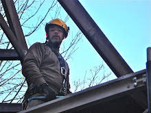
Yesterday Ansel accompanied me for a hike into the canyon despite suffering from a cold. We chose to hike down Hermit’s trail, descending 1,800’ to a dripping spring, for a round trip distance of 5 miles. We observed the incredible geology close-up, seeing fossils and animal tracks left here some 275 million years ago. We rested in the “red rock”- a sandstone deposit making up perhaps the most colorful band of rock in the park. Here we found a creek that had cut it’s own canyon through the sandstone, creating fantastic and beautiful shapes. We had a mishap with the camera, and so we are currently back using the old standby gifted to us by Brad.
Today, Saturday April 9, we awoke to a few inches of snow. All the tent campers were furiously bugging out. I rolled over and turned up the thermostat. Life in the Airstream is good.
posted by Chris Koehn at
4:23 PM
![]()

0 Comments:
Post a Comment
Subscribe to Post Comments [Atom]
<< Home